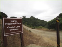
 The Parks and Recreation designation generally includes regional parks, community and neighborhood parks, and special use facilities, such as golf courses, historic homes and gardens, linear parks, and trails. Typical building types include park restrooms and ancillary park buildings. Recreation centers, community centers, nature centers, and golf course club houses and pro shops may also be located within some parks. Future changes to parks and recreation facilities are expected to include park improvements and the construction of new facilities to accommodate the changing recreational and social needs of the Hayward community.
Allowed Uses
- Parks, recreation facilities, open space, and trails
- Golf courses
Supporting Uses
- Ancillary educational and recreational support uses
- Community gardens
- Community centers and nature centers
- Golf course club houses and pro-shops
Development Standards
- Density: Not applicable
- Maximum FAR: 0.15
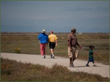 The Baylands designation generally applies to the open space resources located along the Hayward shoreline. Future changes to the Baylands are expected to include the continued restoration of salt and fresh water marshes and upland habitat, improvements to regional levees to protect the shoreline from rising sea levels, and the construction of various trails and compatible recreational facilities throughout the area.
Allowed Uses
- Salt and freshwater marsh
- Upland habitat
Supporting Uses
- Ancillary educational and recreational support uses that are compatible with the ecology of the Bay and Baylands (fishing, hiking and bicycling, bird watching, wetland and marshland tours, and kayaking)
- Nature centers
Development Standards
- Density: Not applicable
- Maximum FAR: 0.05
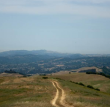
The Limited Open Space designation generally applies to established cemeteries and hillside areas that are largely undevelopable due to natural resources, slopes, or other hazards. Limited Open Space areas are not anticipated to change substantially in the future, and will generally remain as undeveloped open space and grazing land.
Allowed Uses
- Permanent open space
- Grazing lands
Supporting Uses
- Detached single-family homes (on large lots)
- Agriculture
- Cemeteries
- Hiking and biking trails
Development Standards
- Density: A maximum of 0.2 dwelling units per net acre. A minimum density is not required.
- FAR: Not applicable